Katherine Lundquist (14-ERD-024)
Abstract
High-resolution simulations of atmospheric flow are critical in applications such as wind energy, hydropower, power grid capacity, atmospheric transport and dispersion, and regional down-scaling of climate predictions. Grid nesting, a technique using multiple telescoping grids at increasing resolution, provides the framework for multiscale simulations. However, in practice, there are limitations that prevent the application of this technique to simulations of flow over complex terrain, thus preventing current modeling tools from producing accurate multiscale high-resolution atmospheric simulations. Our objective is to create an atmospheric numerical modeling framework that dynamically integrates simulations at multiple physical scales from the microscale of 1 to 1000 m, to the mesoscale of 1 to 200 km. We will use the immersed boundary method, a computational fluid dynamics approach for simulating fluid and structure interactions, to enable this numerical tool to handle complex terrain and urban geometries at the microscale. This high-fidelity approach will allow integrated simulations at previously unapproachable scales and will facilitate state-of-the-art research in atmospheric sciences and environmental engineering. The capability we develop will open the door to new atmospheric applications that have not been possible because of model limitations, including forecasting for wind energy, predicting atmospheric transport and dispersion, and down-scaling atmospheric simulations.
Our proposed numerical model will directly benefit wind energy development, addressing the critical need for multiscale models capable of handling complex terrain. We expect to develop our multiscale modeling framework within the Weather Research and Forecasting model, through the LLNL Atmospheric Modeling Testbed. Our framework will be made available to the community of more than 10,000 Weather Research and Forecasting model users and will accelerate research with national security relevance and impact the larger atmospheric science community. Our modeling effort will expand atmospheric modeling capabilities, allowing for additional opportunities such as atmospheric modeling for hydropower applications and energy grid capacity.
Mission Relevance
Our project will directly benefit research on wind energy with a model capable of handling complex terrain, in support of the Laboratory's strategic focus area in energy and climate security. It will benefit climate and atmospheric research through improved knowledge of down-scaling, in support of the Laboratory's core competency in earth and atmospheric science. In addition, it will provide high-fidelity research-grade simulations relevant to the core competency in high-performance computing, simulation, and data science for improving tools for responding to atmospheric releases of hazardous materials, in support of the Laboratory's national security mission.
FY15 Accomplishments and Results
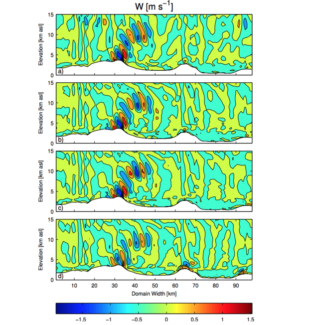
In FY15 we (1) completed the code development required to use standard initializations with the immersed boundary method in the Weather Research and Forecasting model, (2) modified the radiation schemes to include topographic shading and account for the incident angle of radiation when the immersed boundary method is used, (3) continued validation and research of our vertical grid nesting capability, and (4) continued the development of complex terrain flow capability for the immersed boundary method interface.


